Prestige Park Street Location
Find Us
Velachery | South Chennai
Prestige Park Street on the map
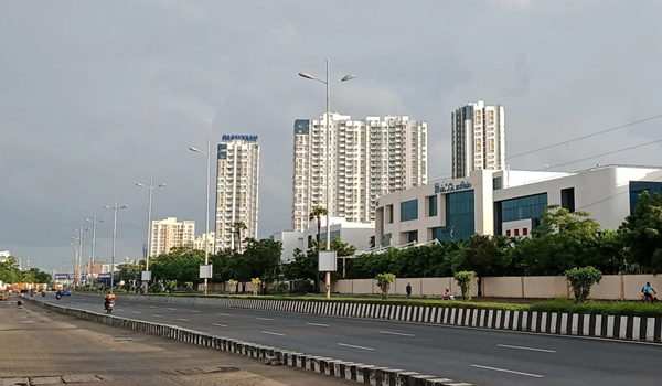
Prestige Park Street Location places the address at 140, Velachery 100 Ft Road, Velachery, Chennai 600042, at roughly 12.990651° N, 80.219555° E on the map. The site connects straight to Velachery 100 Ft Road and on toward Chennai International Airport, with Velachery MRTS Station about 800 m away and Guindy Metro Station around 4.4 km. Velachery town, the Guindy Industrial Estate and the Taramani tech belt all stay within an easy drive.
The updated brief frames location as one of the project's strongest advantages. Velachery is inside the Chennai Metropolitan Area, between the Taramani Tech Belt and the OMR IT corridor, with Guindy Industrial Estate immediately north. Chennai Metro Phase 2 opens in stages through the late 2020s, and Chennai corridors have historically re-rated residential pricing in the 12 – 24 month window after operational connectivity arrives.
Prestige Park Street Address

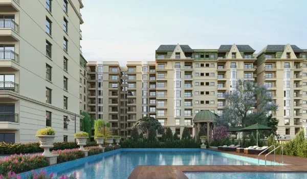
Prestige Park Street's address is 140, Velachery 100 Ft Road, Velachery, Chennai 600042. The address balances neighbourhood convenience with improving regional connectivity, and is inside the Velachery-corridor employment envelope rather than on its edge. Planning sanction for the site falls under CMDA (the Chennai Metropolitan Development Authority). The development comprises 252 apartments across 4 towers on 3.48 acres, offering 3, 4 and 4.5 BHK configurations sized from 2,280 sq ft up to 4,288 sq ft (super built-up).
Prestige Park Street Connectivity

One of the most important factors in assessing a residential property's value is its connectivity. The project is on the Velachery 100 Ft Road corridor in South Chennai, with access to GST Road and OMR, the operational MRTS line, the Chennai Metro Blue Line at Guindy, and the airport 7.3 km away.
Road Connectivity

| Corridor | Distance from site | Notes |
|---|---|---|
| Velachery 100 Ft Road | At the site boundary | Primary frontage; direct access north to Guindy and south toward Pallikaranai |
| Velachery Bus Terminus | 1.2 km | MTC terminus and local retail centre |
| Taramani Tech Belt (Tidel Park, Ramanujan IT City) | 3.2 km | The nearest large IT employment cluster |
| Guindy | 3.9 km | Industrial estate, railway station and Blue Line metro |
| Outer Ring Road (via Perungudi) | 5 km | East-west link to Vandalur, Tambaram and the GST Road belt |
| Pallikaranai | 5.9 km | Southern residential belt via Velachery – Tambaram Main Road |
| Chennai International Airport | 7.3 km | Via Velachery 100 Ft Road and GST Road, about 14 minutes off-peak |
| Sholinganallur (OMR) | 13 km | Mid-point of the OMR IT corridor |
| Siruseri SIPCOT IT Park | 18.8 km | The outer end of the OMR IT corridor |
Velachery 100 Ft Road is the corridor's primary arterial link, connecting north to Guindy and the central business district and south toward Pallikaranai. The proposed Outer Ring Road interchange near Velachery will provide east-west peripheral access without entering the central road network, an underrated long-horizon connectivity asset.
Air Connectivity

The proposed Velachery to St Thomas Mount MRTS extension, a 4.5 km stretch awaiting final safety clearance, would materially upgrade second-mode connectivity.
| Mode | Detail |
|---|---|
| Chennai Suburban Rail Phase 1 | Beach – Velachery MRTS corridor operational, with a Velachery to St Thomas Mount extension planned |
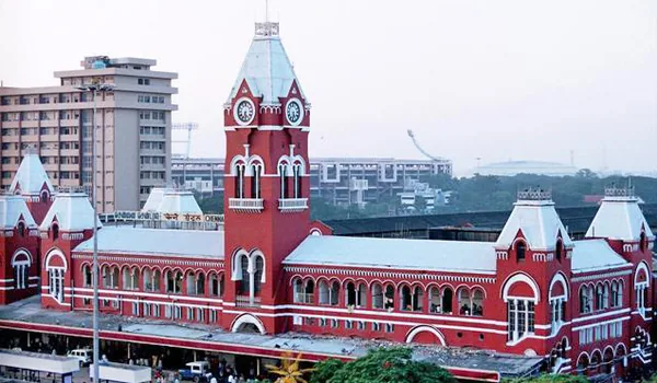
| Velachery Railway Station | 800 m, terminus of the Beach – Velachery MRTS line, operated by Southern Railway |
| Chennai International Airport | 7.3 km via GST Road, domestic and international terminals operational |
| Chennai International Airport expansion | New integrated terminal operational, with further airside and terminal capacity work continuing |
Metro Connectivity
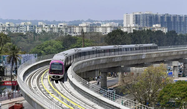
The most transformative connectivity event for the Velachery corridor is the under-construction Chennai Metro Phase 2.
| Item | Detail |
|---|---|
| Corridors | Corridor 3 (Madhavaram → SIPCOT) and Corridor 5 (Madhavaram → Sholinganallur) serve the southern belt |
| Length | Roughly 119 km across the three Phase 2 corridors |
| Stations | Serving Madhavaram, Perambur, Thousand Lights, Guindy, Adyar, Velachery and Sholinganallur |
| Velachery MRTS station role | Operational MRTS terminus on the Chennai Beach – Velachery line, 800 m from the project |
| Nearest operational metro | Guindy Metro Station on the Blue Line, 4.4 km from the project |
| Distance from Prestige Park Street | 800 m to Velachery MRTS Station; 4.4 km to Guindy Metro Station |
Chennai Metro Phase 2 will materially change the corridor's commute economics, a Velachery MRTS to Guindy segment would compress what is today a 45 – 70 minute road commute into roughly a 30 – 35 minute metro ride at consistent peak and off-peak frequencies. Chennai localities have historically priced in a 25 – 40% appreciation in the 12 – 24 months bracketing operational metro segments (observed across Indian metro networks). Metro projects in Chennai have historically seen timeline movement, so treat this as a directional positive and verify construction status on a site visit.
Bus Connectivity
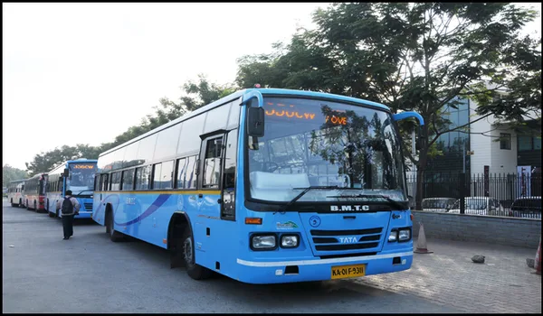
MTC and TNSTC services operate along the Velachery 100 Ft Road corridor, with the Velachery bus terminus approximately 1.2 km from the site and MTC services running the GST Road route to the airport and into the city.
Tech Parks and Employment Centres Near Prestige Park Street
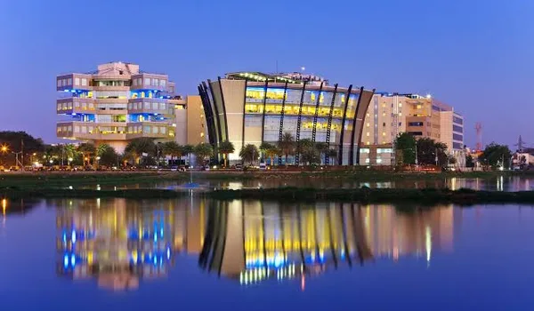
Distances below are road distances from Velachery.
The corridor's employment density is the single most important data point for the project's location case. The concentration of IT employment at Taramani and along OMR, together with the Guindy commercial belt, implies sustained residential demand, supporting both rental yields and capital appreciation.
| Tech / employment park | Distance | Significance |
|---|---|---|
| Taramani Tech Belt | 3.2 km | Tidel Park, Ramanujan IT City and allied IT occupiers |
| Guindy Industrial Estate | 3.9 km | One of Chennai's oldest industrial and commercial estates |
| Guindy Metro Station | 4.4 km | Blue Line interchange into the central business district |
| Perungudi IT Park | 6 km | OMR IT corridor – offices, hospitality and retail |
| Chennai International Airport | 7.3 km | Airport operations, retail and hospitality employment |
| Sholinganallur IT Park | 12 km | OMR IT corridor, large-format technology campuses |
| TCS Siruseri | 18.8 km | SIPCOT IT Park, the outer end of the OMR corridor |
Top Schools Near Prestige Park Street
| School | Type | Distance |
|---|---|---|
| AGR Global School | CBSE | 0.3 km (Velachery Main Road) |
| Tatva School | Cambridge | 0.3 km (Velachery) |
| D.A.V. Public School | CBSE | 0.4 km (Velachery Main Road) |
| Montfort Matriculation Higher Secondary School | State Board | 1 km (Surana Nagar, Velachery) |
| Sunshine Chennai Senior Secondary School | State Board | 1.5 km (Velachery) |
| Vana Vani Matriculation Higher Secondary School | Matriculation | 4 km (IIT Madras campus, Adyar) |
| Modern Senior Secondary School | CBSE | 5 km (Adyar) |
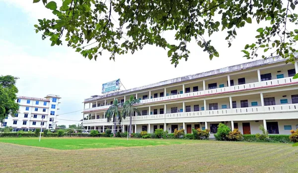
AGR Global School and Tatva School (0.3 km each) and D.A.V. Public School (0.4 km) are the closest options, all within walking distance on Velachery Main Road. Montfort Matriculation Higher Secondary School is 1 km and Sunshine Chennai Senior Secondary School 1.5 km, covering the early-years and middle-school window.
Best Hospitals Near Prestige Park Street

| Hospital | Speciality | Distance |
|---|---|---|
| Prashanth Super Speciality Hospital | Maternity, paediatrics and surgery | 1.4 km (Velachery Main Road) |
| Anbu Hospital | General and emergency care | 1.5 km (Velachery) |
| Apollo Hospital OMR | General and multi-specialty | 5 km (Perungudi) |
| Dr. Kamakshi Memorial Hospital | Multi-specialty | 5.6 km (Pallikaranai) |
| MIOT International Hospital | Orthopaedics, trauma and cardiology | 8 km (Manapakkam) |
| Fortis Malar Hospital | Cardiac, neurology and paediatrics | 8 km (Adyar) |
| Gleneagles Global Health City | Liver transplant and oncology | 10 km (Perumbakkam) |
| Apollo Hospital Greams Road | Cardiology, cancer and transplants | 12 km (Thousand Lights) |
For day-to-day care, Prashanth Super Speciality Hospital is 1.4 km away on Velachery Main Road and Anbu Hospital 1.5 km. For tertiary care, Apollo Hospital OMR at Perungudi is 5 km, Dr. Kamakshi Memorial Hospital 5.6 km, and the Manapakkam and Adyar cluster, MIOT International and Fortis Malar, 8 km. Gleneagles Global Health City at Perumbakkam (10 km) and Apollo Greams Road (12 km) cover transplant and oncology.
Retail, Hospitality and Lifestyle Near Prestige Park Street
| Destination | Distance | Notes |
|---|---|---|
| Local retail (Velachery Main Road) | 0.5 km | Daily essentials, groceries, banks |
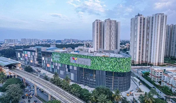
| Phoenix MarketCity (Velachery) | 0.5 km | 263+ stores, Luxe IMAX, food court |
| Palladium Mall (Velachery) | 0.5 km | Premium retail inside the Phoenix compound |
| Grand Square Mall (Velachery) | 1 km | PVR Cinemas, food street, 3.5 lakh sq ft |
| Business hotels around Guindy and the OMR corridor | 5 – 10 km | Corporate hospitality serving the IT belt |
| Nexus Vijaya Mall (Vadapalani) | 11 km | 650,000 sq ft, IMAX, SPAR hypermarket |
| VR Chennai (Anna Nagar) | 13 km | 10-screen cinema, premium retail |
| Express Avenue (Royapettah) | 14 km | Large central-city mall and entertainment |
The corridor's mature retail and lifestyle ecosystem is concentrated around Guindy and Adyar, while Velachery Main Road retail covers daily essentials within about a kilometre. Phoenix MarketCity and Grand Square Mall both sit within about a kilometre, so large-format retail is already established in Velachery itself.
Places to Visit near Prestige Park Street
Phoenix MarketCity – 0.5 km
Phoenix MarketCity on Velachery Main Road is the largest mall in South Chennai, with a full cinema, food court and retail mix. It is the anchor leisure destination for the Velachery catchment and reachable in well under fifteen minutes off-peak.
Guindy National Park – 10.7 km
Guindy National Park is one of the few national parks located inside a major Indian city, adjoining the Raj Bhavan estate. It holds a deer park, a snake park and a children’s park, and is the closest large protected green space to the project.
Edward Elliot’s Beach – 10.9 km
Elliot’s Beach at Besant Nagar is the quieter alternative to Marina, with a promenade, cafes and the Ashtalakshmi Temple at its northern end. It is the standard weekend evening destination for South Chennai families.
Anna Centenary Library – 11.2 km
The Anna Centenary Library at Kotturpuram is one of the largest libraries in Asia, with a children’s section, an auditorium and extensive reading floors. It is between Velachery and the city centre.
Snow Kingdom – 11.5 km
Snow Kingdom is an indoor snow-themed entertainment park, a fixed-weather family destination that runs year-round regardless of the Chennai heat.
Velachery
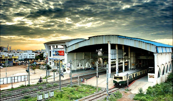
Velachery is a residential and commercial neighbourhood in South Chennai, about 11 km south of the city centre. It grew from a village beside Velachery Lake into one of the city's most established suburbs, driven by the IT corridor at Taramani and along OMR, the MRTS rail link, and large-format retail.
Velachery and its Connectivity
Velachery has road access to the rest of Chennai primarily via Velachery 100 Ft Road and the Outer Ring Road, with MTC bus services along the corridor. The under-construction Chennai Metro Phase 2 and the Chennai Suburban Rail Phase 1 alignment will both add mass-transit capacity to the belt through 2027.
Road Connectivity in Velachery
The Velachery area connects to the major roads of South Chennai, including:
- Velachery 100 Ft Road
- Chennai Outer Ring Road
- Velachery – Tambaram Main Road
- Guru Nanak Road
- GST Road (to Chennai International Airport)
- Taramani Link Road
- Outer Ring Road (via Perungudi)
Metro Connectivity in Velachery
Velachery does not have an operational metro station yet. The nearest is Guindy Metro Station, 4.4 km from the project on the Blue Line. Velachery MRTS Station, on the operational MRTS network, is about 800 m away, and a Velachery – St Thomas Mount MRTS extension is planned.
Airport Connectivity in Velachery
Velachery is 7.3 km from Chennai International Airport, a straightforward run down GST Road. GST Road connects the area to both terminals, 7.3 km away, in about 14 minutes off-peak.
Key Distances From Prestige Park Street
- Velachery Bus Terminus – 1.2 km
- Velachery MRTS Station – 800 m
- Guindy Industrial Estate – 3.9 km
- Velachery 100 Ft Road – at the site boundary
- Taramani Tech Belt – 3.2 km
- Chennai International Airport – 7.3 km
- OMR IT Corridor (Perungudi) – 6 km
- Adyar – 7 km
- Guindy – 3.9 km
- Sholinganallur (OMR) – 12 km
Honest Trade-offs
Buying on a structurally re-rating corridor involves trade-offs that buyers should evaluate transparently.
- Traffic and commute. Velachery 100 Ft Road is a high-volume arterial with peak-hour congestion at the Velachery junction. Until Chennai Metro Phase 2 opens, the road commute to central Chennai is the primary mode and can run 40 – 60 minutes at peak. Velachery MRTS Station, about 800 m away, already offers a rail alternative into the city.
- Development stage. Velachery and the Velachery outer cluster are at a stage where tertiary healthcare is concentrated 8 – 12 km away at Manapakkam, Adyar and Perumbakkam, though day-to-day retail, schools and general hospitals all sit within about 1.5 km.
- Arterial road noise. The site fronts Velachery 100 Ft Road, a high-volume arterial. Modern UPVC double-glazing materially attenuates traffic noise on the upper floors. Buyers sensitive to road noise should validate this on a site visit at a peak evening hour.
- Construction-period density. Multiple large projects are under construction across the corridor, the Taramani IT campus expansion, the OMR corridor build-out and Chennai Metro Phase 2 civil works. The 2026 – 2028 period will see increased heavy-vehicle movement on Velachery 100 Ft Road and the access roads. Long-horizon buyers absorbing this trade-off benefit from the post-2030 mature corridor.
The Investment Case
The investment case for the location of Prestige Park Street reduces to four numbers. These are Velachery market figures supplied by the client; verify current rates independently before underwriting them.
| Metric | Value |
|---|---|
| Velachery 5-year price appreciation | 41.4% – 43.7% |
| Implied 5-year CAGR | 7.0% – 7.5% |
| Forecast CAGR to 2030 | 7% – 9% |
| Velachery apartment rate (per sq ft) | ₹8,600 – ₹17,050 |
The corridor's appreciation has been driven by infrastructure announcements, partial operational delivery (Tidel Park, the Taramani Tech Belt), and the metro Chennai Metro Phase 2 civil construction visible on the ground. The next leg of re-rating is expected to be triggered by the Chennai Metro Phase 2 corridors opening in stages through the late 2020s and by continued office absorption along OMR.
For a buyer evaluating Prestige Park Street, the location case rests on operational employment, under-construction connectivity, and observable price action rather than pure speculation. Past appreciation is not a guarantee of future returns, and buyers should verify current rates and rental yields independently before underwriting them.
Plan a Site Visit
The Prestige Park Street site is accessible from Velachery 100 Ft Road via the Velachery approach. Use the Contact page to schedule a site visit. A guided tour covers the tower positioning, the central amenity podium location, the boundary green-belt walkthrough, and the sample apartment unit display. Confirm current site-office timings with the sales team when you book, and test your specific commute on a working morning before signing.
Location & connectivity FAQs
Distances, drive times and what's actually within reach of the site, airport, metro, rail, workplaces, schools and hospitals. Figures are approximate and measured by road unless stated otherwise.
Prestige Park Street is at 140, Velachery 100 Ft Road, Velachery, Chennai 600042, in the Velachery corridor of South Chennai. The micro-market is on the Velachery 100 Ft Road corridor and feeds into GST Road and OMR for onward connectivity.
Chennai International Airport is 7.3 km away via GST Road, about 14 minutes off-peak.
Velachery MRTS Station, the southern terminus of the Chennai Beach – Velachery MRTS line, is approximately 800 m from the project, and Guindy Metro Station on the operational Blue Line is 4.4 km away. Chennai Metro Phase 2 corridors are opening in stages through the late 2020s, so verify construction status on a site visit.
Velachery Railway Station is approximately 800 m away and is operated by Southern Railway. The proposed Velachery to St Thomas Mount MRTS extension, a 4.5 km stretch awaiting final safety clearance, would materially upgrade second-mode connectivity.
The Taramani Tech Belt, with Tidel Park and Ramanujan IT City, is about 3.2 km away. Guindy Industrial Estate is about 3.9 km, and the OMR IT corridor at Perungudi and Sholinganallur runs south from the site.
AGR Global School and Tatva School are both about 0.3 km away and D.A.V. Public School about 0.4 km, all on Velachery Main Road. Montfort School is about 1 km and Sunshine Chennai Senior Secondary School about 1.5 km.
Velachery Main Road retail covers daily essentials within 0.5 km. Phoenix MarketCity (Velachery) is 0.5 km, Grand Square Mall 1 km, and Express Avenue (Royapettah) 14 km. Business hotels cluster around Guindy and the OMR corridor, within 5 to 10 km.
Chennai Metro Phase 2 adds three corridors across roughly 119 km, with Corridor 3 (Madhavaram to SIPCOT) and Corridor 5 (Madhavaram to Sholinganallur) serving the OMR belt. A Velachery MRTS to Guindy link segment would compress what is today a 45 – 70 minute road commute into roughly a 30 – 35 minute metro ride. Chennai localities have historically priced in 25 – 40% appreciation in the 12 – 24 months bracketing operational metro segments, though past patterns are not a guarantee.
Velachery is an emerging residential area with active under-construction supply and improving social infrastructure. Large-format retail is within about a kilometre at Phoenix MarketCity and Grand Square Mall, while tertiary healthcare is concentrated 8 to 12 km away toward Manapakkam, Adyar and Perumbakkam.
Velachery 100 Ft Road sees peak-hour congestion at the Velachery junction and toward Kathipara, and the road commute to central Chennai can run 40 – 60 minutes at peak until the metro opens. The site is within the airport's operational influence zone though not in the direct flight path, validate noise on an evening site visit. The 2026 – 2028 period will also see heavy construction traffic on the corridor.
Location-based pricing depends on tower, floor, facing, and unit size. Check the full price list on the Prestige Park Street Price page, and ask the sales team for the unit-level cost sheet including floor-rise and preferential location charges.
Explore the neighbourhood in detail
Download the brochure for a full connectivity map or speak with our sales team for directions to the site.